- Published:
- Monday 20 November 2023 at 2:11 pm
- Location:
- Melbourne metropolitan
- Published by:
- Department of Government Services
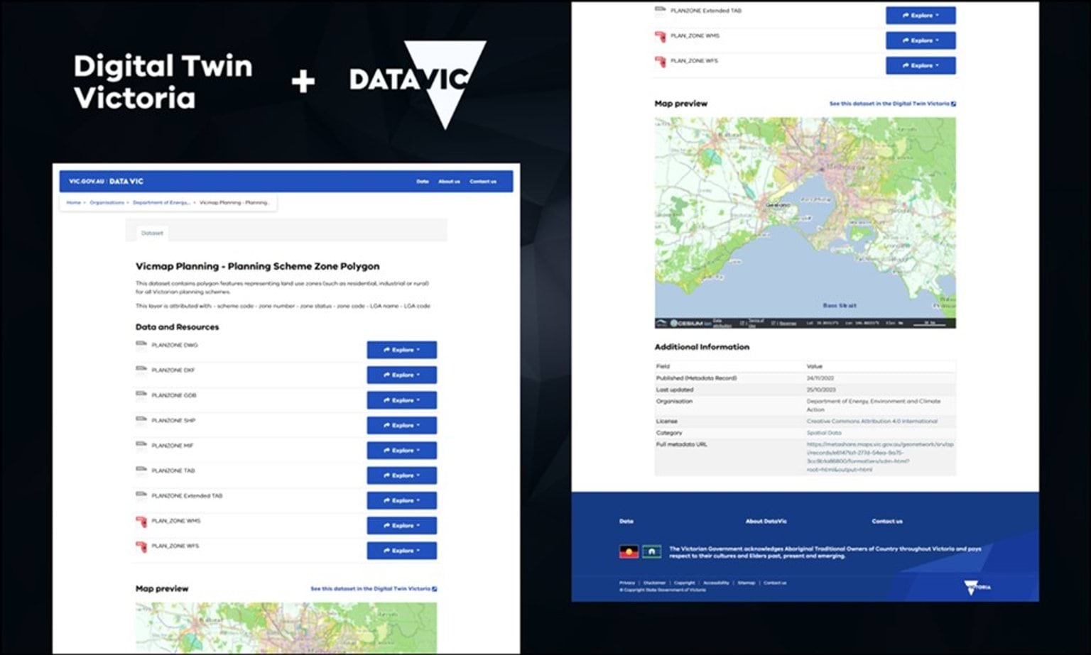
The interactive data preview capability
The capability provides real benefits for GIS specialists and non-technical users alike. Alongside each spatial dataset’s description, a map visualisation allows you to zoom and pan spatial data to better understand what is available.
When download is not a convenient option, the data preview and access to technical attributes and metadata can help users decide whether it’s fit for purpose.
Previews are enabled for 1038 Web Map Service (WMS), GeoJSON, and Keyhole Markup Language (KML) records.
The teams at DataVic and DTV with CSRIO’s Data61 joined forces on this technical collaboration to provide users with a fully integrated experience while re-using existing government technology.
The Platforms
Digital Twin Victoria (DTV)
The DTV platform is the most comprehensive digital model assembled for Victoria. It brings together masses of 2D, 3D and live data in a single online place open for everyone to use.
DataVic
DataVic is the place to discover and access Victorian government open data. Approximately 5,700 data assets are available of which more than 1,200 are spatial data.
Updated